Slope movements and retaining walls
Multiple sensor points along a slope detect movements over long distances. Early detection of landslides and subsidence.

Digitally record absolute positional changes—with 2-millimeter accuracy. Suitable for bridges, dams, buildings, and retaining walls.


Multiple sensor points along a slope detect movements over long distances. Early detection of landslides and subsidence.
Wide-area monitoring of dam geometry using antennas at multiple points. Suitable for arch and gravity dams.

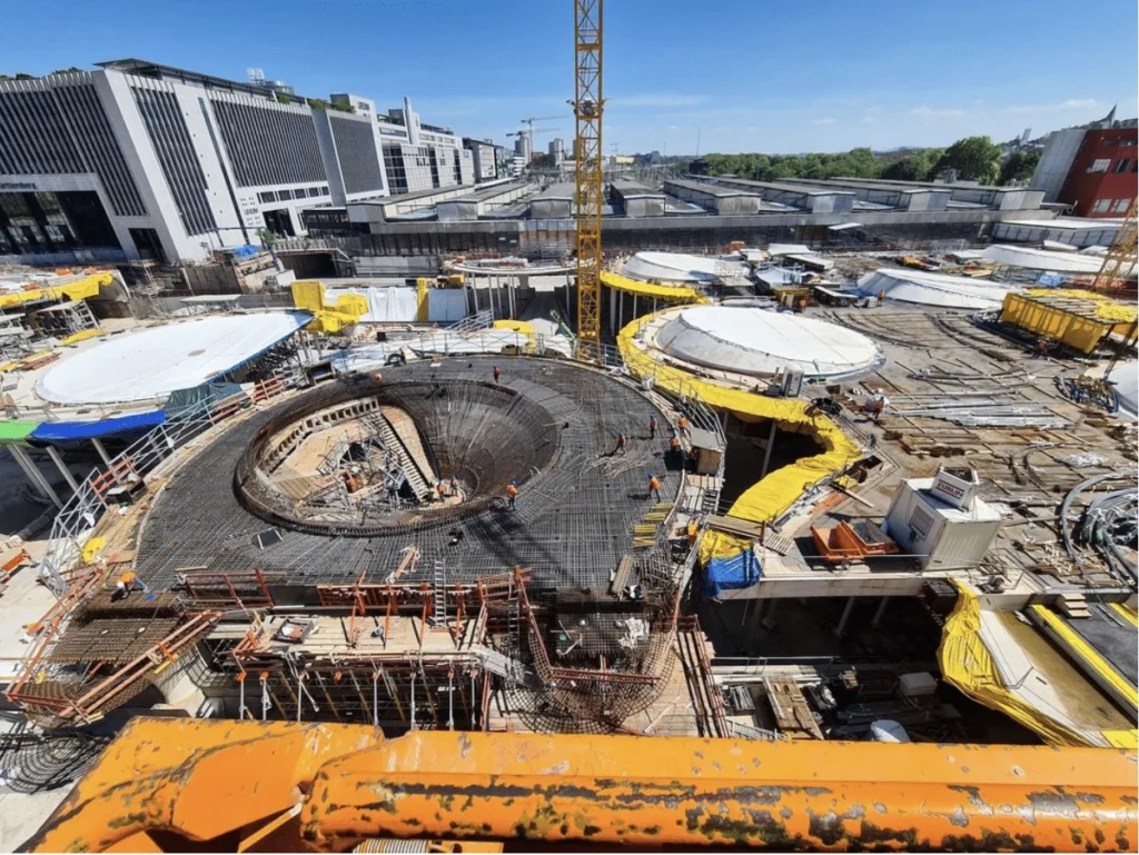
For large-scale projects involving civil engineering, vibrations, and settlement over several hundred meters, the GNSS system tracks movements over a wide area.
For particularly long bridges, the GNSS system supplements point measurements taken with 6D or 3D sensors to provide a large-scale geometric analysis.
Multiple sensor points distributed across the entire structure or site, with data analyzed collectively in the data hub. Suitable for structures spanning several hundred meters.

All measurement data in a single dashboard. CSV export for structural engineers and reports, API integration for third-party sensors, and multi-tenant support for complex projects.
Each sensor point provides its position relative to a fixed reference point. Ideal for monitoring slope movements or settlement over long distances.
Transmission via LTE and LTE-M directly to the data hub. Also suitable for remote locations without an on-site power grid.
If a threshold is exceeded, our system automatically sends an email notification.
Selected projects using the GNSS system.
Continuous monitoring of structural movements in the historic reception building during the critical construction phase


High-precision building monitoring of settlement and crack development to assess damage caused by subway construction work.


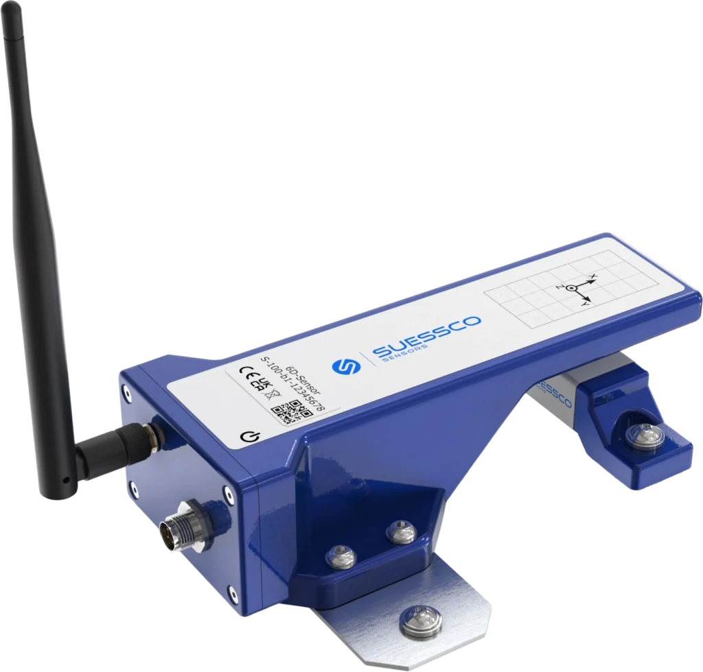
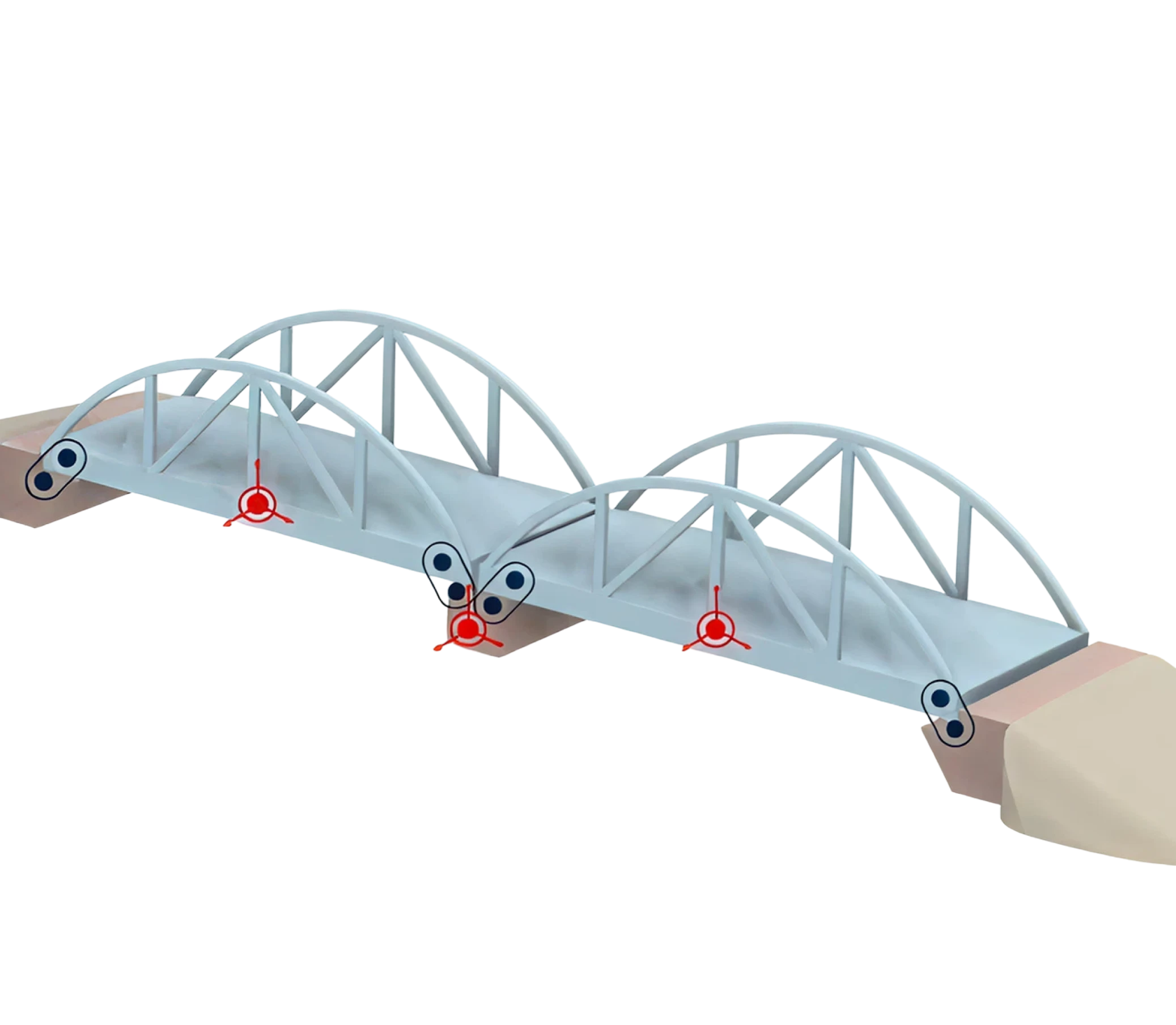
Movements along three spatial axes and rotations around three axes are measured simultaneously. Repeatability: ±50 µm and ±1°. Patent...
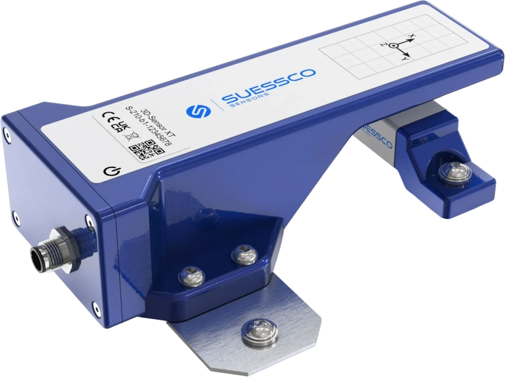
Three spatial axes with a repeatability of ±50 µm. External battery box for long measurement intervals and hard-to-reach locations. Made in Austria.
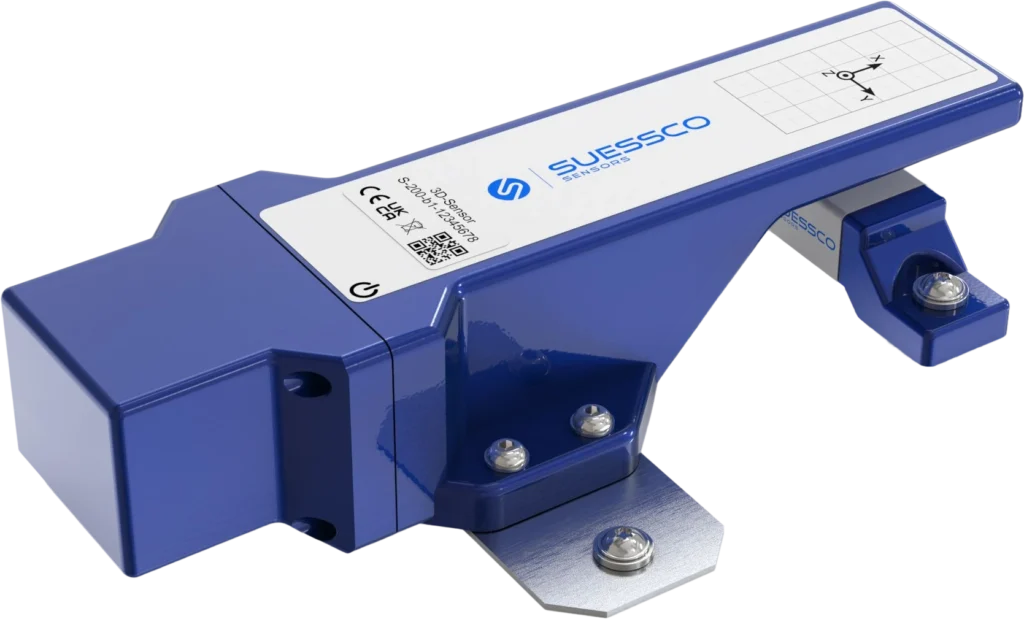
Absolute position changes in the X, Y, and Z axes with a repeatability of ±50 µm. Wireless transmission via LTE-M and Wi-Fi. Made...
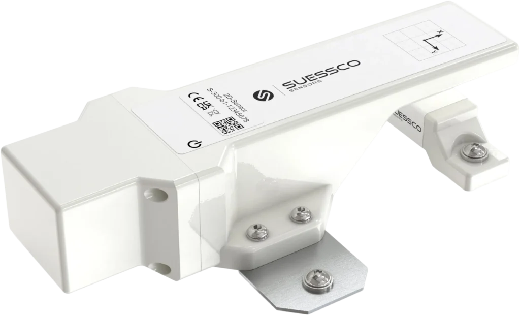
Relative motion in the X and Y directions with a repeatability of ±100 µm. Built-in temperature sensor. 10-year battery life. Made in Austria.